
Publications
|
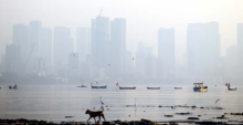
Gufran Beig Mumbai spent Rs 493 crore for clean air, and on around 1,000 ‘missing’ EV buses https://indianexpress.com/article/cities/mumbai/rs-493-crore-spent-e-buses-bmc-mumbai-clean-air-10891903/ Beig, Gufran. (2026, September 24). Mumbai spent Rs 493 crore for clean air, and on around 1,000 ‘missing’ EV buses. The Indian Express. |
|
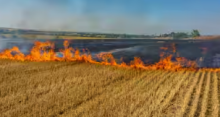
Gufran Beig Winter is coming – and signs are ominous https://timesofindia.indiatimes.com/city/delhi/farm-fires-are-lit-super-el-nino-to-tell-on-winter-rain-pollution/articleshow/134443488.cms Beig, Gufran. (2026, September 24). Winter is coming – and signs are ominous. The Times of India. |

|
C P Rajendran Journeying through the major Himalayan Indian earthquakes: The knowns and unknowns https://link.springer.com/chapter/10.1007/978-981-92-3784-5_8 Rajendran, K., & Rajendran, C. P. (2026). Journeying through the major Himalayan Indian earthquakes: The knowns and unknowns. In V. M. Tiwari (Ed.) Himalayan natural hazards (pp. 173-196). Springer. |

|
Dinesh K Srivastava QGP studies in India: A legacy of Bikash Sinha https://link.springer.com/chapter/10.1007/978-3-032-27608-7_9 Srivastava, D. K. (2026). QGP studies in India: A legacy of Bikash Sinha. In T. Nayak, et al. (Eds) Quark-Gluon Plasma: 50 years and beyond (History of Physics Series, pp.59-65). Springer. The paper examines the disappearance of Tulare Lake (California) and the Aral Sea (Central Asia) - where river diversions for irrigation destroyed millennia-old lakeshore societies - as emblematic cases of global lake desiccation due to over-exploitation, silting, and waste dumping. It is pointed out that lakes, ponds, and other waterbodies would play an increasingly important role in recharging underground aquifers and offering a relief on a planet under stress due to climate change. |
|
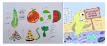
M Sai Baba World Cleanup Day https://niascomm.in/2026/09/20/world-cleanup-day/ SciComm@NIAS Every piece of litter left on a street, plastic bottle thrown into a river, or food discarded unnecessarily adds to a much larger environmental problem. Clean up is often seen as something that happens after a place becomes dirty. But a more sustainable approach is to make cleanliness a culture, not a campaign. While humanity struggles to cope and keep the environment cleaner, another challenge daunts everyone: the need to clean up the spaces in the mind. |

|
Sanjay Kumar Srivastava Warning sounded from Peru about humid heat in Patna https://www.newindianexpress.com/opinion/2026/Sep/17/warning-sounded-from-peru-about-humid-heat-in-patna Srivastava, Sanjay Kumar. (2026, September 18). Warning sounded from Peru about humid heat in Patna. The New Indian Express. |

|
Nithin Nagaraj Advancing forest fires classification using Neurochaos learning https://doi.org/10.1109/ACCESS.2026.3734132 Pant, K. K., Ajai, A. S. Remya., & Nagaraj, Nithin. (2026). Advancing forest fires classification using Neurochaos learning. IEEE Access 14. 145861-145892 |

|
Biju Dharmapalan The space race must not become a race against the ozone layer https://www.thestatesman.com/supplements/science_supplements/the-space-race-must-not-become-a-race-against-the-ozone-layer-1503639121.html Dharmapalan, Biju. (2026, September 16). The space race must not become a race against the ozone layer. The Statesman |