
Publications

|
S Udayakumar Assistant Professor, School of Humanities Ethno-technological Perspective of Current Wisdom of Metal Craft and Craftsmanship https://cms.nias.res.in/sites/default/filesefs/2025-04/Ethno_technological_Perspective_of_Curre.pdf Udayakumar, S. Ethno-technological Perspective of Current Wisdom of Metal Craft and Craftsmanship, Tamil Nadu and Karnataka. |
|
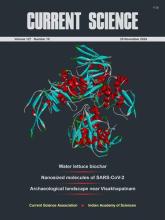
M B Rajani Archaeological landscape of Thotlakonda and Bavikonda near Visakhapatnam, Andhra Pradesh: insights from remote sensing and GIS analysis https://www.currentscience.ac.in/Volumes/127/10/1180.pdf CURRENT SCIENCE, VOL. 127, NO. 10 Thotlakonda and Bavikonda, two important Buddhist heritage sites in Andhra Pradesh, were designated as protected in 1978. However, vague boundary descriptions have caused disputes between preservation advocates and developers. This study uses remote sensing and GIS to analyze the sites and surrounding areas, identifying archaeological features and evaluating the effects of recent land-use changes on their preservation. |
|
Sangeetha Menon co-authored Professor, Consciousness Studies Programme Self, Well-being, and Agency in the Caraka Saṃhitā https://academic.oup.com/jhs/advance-article-abstract/doi/10.1093/jhs/hiae013/7902183 Gautama, P. A., & Menon, S. (2024). Self, Well-being, and Agency in the Caraka Saṃhitā. Journal of Hindu Studies, hiae013. https://doi.org/10.1093/jhs/hiae013 In this study, we examine three different conceptions of self within the Caraka Saṃhitā (CS), a classical Sanskrit Āyurveda text, based on three interrelated notions of suffering, well-being, and the nature of the self’s agentic pursuit of remedy. These are—(i) the phenomenal self, (ii) the expansive self, and (iii) the transcendental self. The phenomenal self-in-the-world encompasses its existence across a single lifetime, and as the embodied, agentic self of the ‘sufferer in the here-and-now’, it is the primary subject of the CS. The temporally expansive self is conceived of in relation to the self’s experiences of disease, illness, and well-being as a result of karmic consequence and is therefore expansive (extends beyond the temporal bounds of a single lifetime). It experiences multiple embodied phenomenal subjectivities across an iterative temporal continuum. The ‘transcendental self’, although also temporally expansive, is the unchanging, eternal core of all ‘being’, the seer of all actions, the ‘knowing’ of which is ultimate well-being, and as such, implies the cessation of karmic valence. |

|
Pushya A Gautama co-authored Doctoral Student, Consciousness Studies Programme Self, Well-being, and Agency in the Caraka Saṃhitā https://academic.oup.com/jhs/advance-article-abstract/doi/10.1093/jhs/hiae013/7902183 Gautama, P. A., & Menon, S. (2024). Self, Well-being, and Agency in the Caraka Saṃhitā. Journal of Hindu Studies, hiae013. https://doi.org/10.1093/jhs/hiae013 In this study, we examine three different conceptions of self within the Caraka Saṃhitā (CS), a classical Sanskrit Āyurveda text, based on three interrelated notions of suffering, well-being, and the nature of the self’s agentic pursuit of remedy. These are—(i) the phenomenal self, (ii) the expansive self, and (iii) the transcendental self. The phenomenal self-in-the-world encompasses its existence across a single lifetime, and as the embodied, agentic self of the ‘sufferer in the here-and-now’, it is the primary subject of the CS. The temporally expansive self is conceived of in relation to the self’s experiences of disease, illness, and well-being as a result of karmic consequence and is therefore expansive (extends beyond the temporal bounds of a single lifetime). It experiences multiple embodied phenomenal subjectivities across an iterative temporal continuum. The ‘transcendental self’, although also temporally expansive, is the unchanging, eternal core of all ‘being’, the seer of all actions, the ‘knowing’ of which is ultimate well-being, and as such, implies the cessation of karmic valence. |
|
Pushya A Gautama Doctoral Student, Consciousness Studies Programme Placing well-being: The role of ecology in Āyurveda and Māvilan healing traditions https://link.springer.com/article/10.1007/s43539-024-00133-4 Gautama, P. A., Guruvayoorappan, S., & Menon, S. (2024). Placing well-being: The role of ecology in Āyurveda and Māvilan healing traditions. Indian Journal of History of Science, 59(3), 274-283. This study examines how ecological systems contribute to notions of well-being in two Indic healing traditions– Āyurveda and the Māvilan healing traditions. We focus on the ecological place (or eco-place) as a living and dynamic space within which cultures of knowledge emerge, and healing identities become constructed, fostering multiple somatic, psychological, social, and spiritual correspondences between its human and other-than-human members, and through which a variety of well-being experiences emerge. Three lenses are used for this purpose (i) a narrative ecology of healing, (ii) agentic herbs and co-creative healing, and (iii) healing of natural ecological systems. For the first, the concept of narrative ecology is examined, alongside how healing knowledge emerges in both Āyurveda and the Māvilan healing traditions from human and other-than-human understandings of the world; for the second, we examine how, despite significantly differing engagements with forest ecosystems, the notion of plant-agency can recast healing as a co-creative process in both traditions. For the third, we explore ideas regarding other-than-human illness and therapeutics in Āyurveda and the Māvilan healing traditions. |
|
Sangeetha Menon Placing well-being: The role of ecology in Āyurveda and Māvilan healing traditions https://link.springer.com/article/10.1007/s43539-024-00133-4 Gautama, P. A., Guruvayoorappan, S., & Menon, S. (2024). Placing well-being: The role of ecology in Āyurveda and Māvilan healing traditions. Indian Journal of History of Science, 59(3), 274-283. The role of ecology in shaping notions of well-being in indigenous healing traditions is often overlooked in contemporary well-being discourse. This study examines how ecological systems contribute to notions of well-being in two Indic healing traditions– Āyurveda and the Māvilan healing traditions. We focus on the ecological place (or eco-place) as a living and dynamic space within which cultures of knowledge emerge, and healing identities become constructed, fostering multiple somatic, psychological, social, and spiritual correspondences between its human and other-than-human members, and through which a variety of well-being experiences emerge. Three lenses are used for this purpose (i) a narrative ecology of healing, (ii) agentic herbs and co-creative healing, and (iii) healing of natural ecological systems. For the first, the concept of narrative ecology is examined, alongside how healing knowledge emerges in both Āyurveda and the Māvilan healing traditions from human and other-than-human understandings of the world; for the second, we examine how, despite significantly differing engagements with forest ecosystems, the notion of plant-agency can recast healing as a co-creative process in both traditions. For the third, we explore ideas regarding other-than-human illness and therapeutics in Āyurveda and the Māvilan healing traditions. |
|
Sisir Roy Quantized Redshift and its Significance for Recent Observation https://iopscience.iop.org/article/10.1088/1674-4527/ad6db5 Co-Authored with Arindam Mal, Sarbani Palit , Christopher C. Fulton; Research in Astronomy and Astrophysics, 24:095014 |
|
S Udayakumar Preliminary investigation of the methods of making bone tools: an experimental archaeology perspective http://eprints.nias.res.in/2802/ Udaya Kumar, S. (2024). Preliminary investigation of the methods of making bone tools: an experimental archaeology perspective. Heritage India. |