
Publications

|
C N Vishnuprasad The systemic anti-diabetic effect of polyherbal formulation Varanadi Kashayam is mediated through GLP-1 secretion and DPP4 inhibition https://www.sciencedirect.com/science/article/pii/S0975947626000434?via%3Dihub= Thottappillil, A., Kouser, S., Badiger, A.V., et al. (2026). The systemic anti-diabetic effect of polyherbal formulation Varanadi Kashayam is mediated through GLP-1 secretion and DPP4 inhibition. Journal of Ayurveda and Integrative Medicine 17(4).
|

|
C N Vishnuprasad Health benefits of Ashtaksheera (Eight types of Milk) in Ayurveda: Ancient and modern perspectives https://rfppl.co.in/article/health-benefits-of-ashtaksheera-eight-types-of-milk-in-ayurveda-ancient-and-modern-perspectives/19659?srsltid=AfmBOoom9qw… Loke, V. M., Vishnuprasad, Chethala N., Phadke, A., et al. (2026). Health benefits of Ashtaksheera (Eight types of Milk) in Ayurveda: Ancient and modern perspectives. Indian Journal of Ancient Medicine and Yoga 19(2). 89-90.
|
|
Srikumar M Menon From megaliths to temples: An architectural vocabulary of commemoration https://brill.com/view/journals/arwh/14/2/article-p189_2.xml Menon, Srikumar. (2026). From megaliths to temples: An architectural vocabulary of commemoration. Asian Review of World Histories 14(2). 189-222. |
|
Deepti Navaratna Towards India’s ‘Purusharthas’: Rethinking Culture as Strategy in India’s Civilizational Diplomacy https://www.indica.today/long-reads/towards-indias-purusharthas-rethinking-culture-as-strategy-in-indias-civilizational-diplomacy/ Navaratna, Deepti (2026, June 13). Towards India’s ‘Purusharthas’: Rethinking culture as strategy in India’s civilizational diplomacy. Indica Today. A perspective article about the need to re-position and re-think India's culture strategy as geopolitical strategy. Few nations possess cultural and philosophical depth comparable to India, yet few nations with such depth have underutilized it so profoundly in strategic terms. Indian culture is frequently projected abroad through festivals, cuisine, dance performances, yoga celebrations, tourism campaigns, handicraft exhibitions, and diaspora events. While these remain important expressions of national identity, they are often deployed as isolated spectacles rather than as components of a larger geopolitical architecture.’ |

|
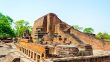
Srikumar M Menon Equinoctial solar illumination in two Saiva temples of the Hoysala period, in Tumkur District, Karnataka https://www.ibpbooks.in/exploring-indian-art-architecture-and-epigraphy-essays-in-honour-of-prof-shrinivas-v-padigar-2-volumes-set/p/64072 Rao, M. K., & Menon, Srikumar. M. (2026). Equinoctial solar illumination in two Saiva temples of the Hoysala period, in Tumkur District, Karnataka. In C. B. Patil (ed.) Exploring Indian art, architecture and epigraphy (pp. 209-218) IBP Books. This article presents two Hoysala temples where the rays of the rising sun on equinoxes illuminate the idol within the sanctum. |

|
S Udayakumar A preliminary ethnoarchaeological study of Kota Pottery, Nilgiri mountains (Tamil Nadu) https://www.ibpbooks.in/south-asian-archaeology-and-art-2024-concise-papers-from-the-26th-international-conference-of-the-european-association-for-so… Udaykumar, S. (2026). A preliminary ethnoarchaeological study of Kota Pottery, Nilgiri mountains (Tamil Nadu). In M. Frenger & M. Zin (Eds.) South Asian archaeology and art 2024 (pp. 182-184). Dev Publishers. |

|
Sharada Srinivasan Archaeological research in the Nilgiri mountains: Report on the first season (2024) https://www.ibpbooks.in/south-asian-archaeology-and-art-2024-concise-papers-from-the-26th-international-conference-of-the-european-association-for-so… Simone, D. D., Anupama, K., Naskidashvili, D., Rao, A., Udaykumar, S., Srinivasan, Sharada., & Trinco, L. (2026). Archaeological research... In M. Frenger & M. Zin (Eds.) South Asian archaeology and art 2024 (pp. 70-72). Dev Publishers. |
|
S Udayakumar Archaeological research in the Nilgiri mountains: Report on the first season (2024) https://www.ibpbooks.in/south-asian-archaeology-and-art-2024-concise-papers-from-the-26th-international-conference-of-the-european-association-for-so… Simone, D. D., Anupama, K., Naskidashvili, D., Rao, A., Udaykumar, S., Srinivasan, Sharada., & Trinco, L. (2026). Archaeological research... In M. Frenger & M. Zin (Eds.) South Asian archaeology and art 2024 (pp. 70-72). Dev Publishers. |