
Publications

|
Sharada Srinivasan Pallava Nataraja Iconography and Cosmic Dance: Explorations of Stellar Connections to Orion and Syrius https://www.ibpbooks.in/glimpses-of-art-and-archaeology-of-india-and-south-asia-felicitation-volume-of-padmashri-k-k-muhammed/p/62514 In: Glimpses of Art and Archaeology of India and South Asia Felicitation Volume of Padmashri K K Muhammed edited by Githa U Badikillaya and O P Pandey. Bharati Prakashan, pp.16-22. The paper touches on the dating of a few key Nataraja bronzes from archaeometallurgical considertations to the Pallava period (c 7th to 9th century), prior to the Chola period and also explores the connections of the iconography to celestial observations of star positions of Orion and Syrius
|
|
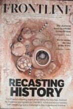
Sharada Srinivasan Iron Age Rewritten: Tamil Nadu’s discoveries rewrite the Iron Age timeline and South India’s past https://frontline.thehindu.com/arts-and-culture/heritage/iron-age-ancient-tamil-nadu-archaeology-history/article69210433.ece Frontline Vol.42(4) March. pp.10-20 Recent archaeological discoveries in Tamil Nadu reveal South India as an early hub of iron smelting, challenging historical timelines. Excavations at sites like Adichanallur and Sivagalai uncover advanced Iron Age culture, |

|
Srikumar M Menon Deep Dive into Buddhas World (Book Review: Casting the Buddha, by Shashank Shekhar Sinha, Macmillan Books). https://www.deccanherald.com/features/books/book-review-deep-dive-into-buddhas-world-3414267 Deccan Herald This book review deals with "Casting the Buddha" authored by Shashank Shekhar Sinha, a book which explores the history of Buddhism in India through the numerous Buddhist monuments which dot the landscape of ancient India. |

|
Malavika Kapur Multilingualism in Children: A marvel or a miracle and yet a mystery New Delhi: Storywell Books Foundation, ISBN 9789395373432 |
|
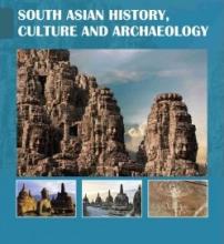
S Udayakumar An Experimental Study of Iron-Smelting Techniques Used in the Nathara-Ki-Pal and Iswal, India: Results for the Reconstruction of Ancient Metallurgical Processes https://www.blackroseindia.com/sahca South Asian History, Culture and Archaeology, 2024, Vol: (4), Issue: (2), PP.221-240 |
|
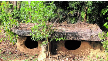
Srikumar M Menon The Moriyas behind the megaliths https://www.deccanherald.com/india/karnataka/the-moriyas-behind-the-megaliths-3332161 Deccan Hearld |
|
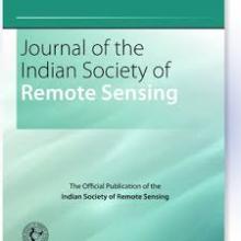
M B Rajani, Arya Pradeep Ancient Valabhi: A Remote Sensing Perspective https://doi.org/10.1007/s12524-024-02087-7 Pradeep, A.S., Rajani, M.B. Ancient Valabhi: A Remote Sensing Perspective. J Indian Soc Remote Sens 53, 1765–1783 (2025). https://doi.org/10.1007/s12524-024-02087-7 |

|
Sangeetha Menon Exploring complexity-entropy, eye-tracking, experience, creativity, familiarity, and emotional responses to 40 paintings of Raja Ravi Varma - father of Indian modern art https://doi.org/10.1504/IJART.2024.143134 Mukhopadhyay, D.& Menon, S. et.al (2024). Exploring complexity-entropy, eye-tracking, experience, creativity, familiarity, and emotional responses to 40 paintings of Raja Ravi Varma-father of Indian modern art. IJART,15.2 (2024): 170-207 |