
Publications

|
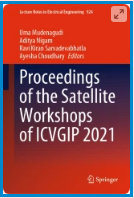
Mythrayi Harshavardhan Project Associate, Heritage Science and Society Programme Spatial Analysis and 3d Mapping Historic Landscapes—Implications of Adopting an Integrated Approach in Simulation and Visualization of Landscapes Proceedings of the Satellite Workshops of ICVGIP 2021, Vol. 924 https://res.us2.list-manage.com/track/click?u=4c96385cee36c21eb5f2510c4&id=585e8c8357&e=ffe444b6f3 |
|
M B Rajani Associate Professor , Heritage Science and Society Programme Mapping Archaeological Remains of 14th Century Fort of Jahanpanah Using Geospatial Analysis Pal, G.K., Rajani, M.B. (2022). In: Mudenagudi, U., Nigam, A., Sarvadevabhatla, R.K., Choudhary, A. (eds) Proceedings of the Satellite Workshops of ICVGIP 2021. Lecture Notes in Electrical Engineering, vol 924. Springer, Singapore. https://link.springer.com/chapter/10.1007/978-981-19-4136-8_6 |

|
Gaurav Pal Senior Research Fellow, Heritage Science and Society Programme Mapping Archaeological Remains of 14th Century Fort of Jahanpanah Using Geospatial Analysis Co-authored with M B Rajani. Proceedings of the Satellite Workshops of ICVGIP 2021 https://trebuchet.public.springernature.app/get_content/c347d62f-4213-4c53-ab93-4e8c9853bcbb?sap-outbound-id=70B97725E9866D5D3F8A4FD4FB35774CAC124778 |

|
M Sai Baba Visiting Professor, School of Natural Sciences and Engineering World TV Day Scicom@NIAS https://res.us2.list-manage.com/track/click?u=4c96385cee36c21eb5f2510c4&id=61de00a304&e=ffe444b6f3 |
|
C P Rajendran Adjunct Faculty, School of Natural Sciences and Engineering The geoheritage value of Ram Setu The Hindu https://res.us2.list-manage.com/track/click?u=4c96385cee36c21eb5f2510c4&id=d2e5e9653f&e=ffe444b6f3 |

|
Tejal Kanitkar Associate Professor, NIAS Rethinking the Economics of Climate Change Rethinking Economics India Network https://www.rethinkeconindia.org/session-1-better-economics-for-clim |

|
M B Rajani Senior Research Fellow, Heritage Science and Society Programme A geospatial study of the layout and extent of the eighteenth-century walled city of Hyderabad Pal, G. K., & Rajani, M. B. (2022). A geospatial study of the layout and extent of the eighteenth-century walled city of Hyderabad. Journal of Geomatics, 16(2), 187-196. https://isgindia.org/jog-vol-16-no-2-october-2022/ |
|
|
Gaurav Pal Associate Professor , Heritage Science and Society Programme A geospatial study of the layout and extent of the eighteenth-century walled city of Hyderabad Pal, G. K., & Rajani, M. B. (2022). A geospatial study of the layout and extent of the eighteenth-century walled city of Hyderabad. Journal of Geomatics, 16(2), 187-196. https://isgindia.org/jog-vol-16-no-2-october-2022/ |